policy brief

Compact, Accessible, and Walkable Communities Help Support Gender Equality

Abstract

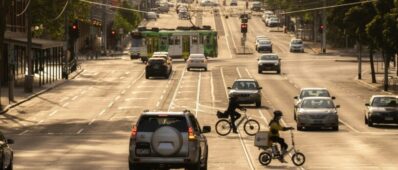
In California, Senate Bill 375 mandates regional planning organizations align their transportation plans with sustainable land use and development strategies to achieve reductions in greenhouse gas emissions. In response, the Southern California Association of Governments’ 2016 Regional Transportation Plan/Sustainable Community Strategy directs nearly 50% of housing and employment growth between 2010 and 2040 into walkable and compact neighborhoods within a one-half mile walking distance from well-serviced transit stops. This approach to land use development can encourage shorter driving trips, greater transit usage, and increased walking and cycling as a result of daily activity destinations being clustered near residential and work locations.1Another bi-product and benefit of compact and accessible communities may be improving gender equality related to travel and activity patterns. Prior research shows segregated and dispersed land uses (i.e., suburban sprawl) can exacerbate gender disparities in daily household travel by separating the public and private realms, and can also constrain women to their immediate neighborhoods.2,3 In contrast, neighborhoods with pedestrian accessible mixes-use centers have been shown to help counter social isolation of women in suburbia.4In addition, compact communities with denser land use and better transit service has been shown to reduce the disproportionate amount of chauffeuring women conduct on behalf of the household.

published journal article

Integrating Autonomous Vehicles in Multimodal Peer-to-peer Shared Mobility Systems and its Network Impacts

Abstract

As public perception of sharing economy in transportation has changed, mobilephone-hailed ridesharing is gaining prominence. The key aspect of capitalizing and promoting better shared-mobility systems depends on the matching rate between the supply and demand for rides. Peer-to-peer (P2P) ridesharing systems devise higher matching rate than pure ridesharing systems by attracting more drivers. Even relaxing the spatiotemporal constraints for participants could increase the chances to be matched. However, we notice that sole P2P ridesharing systems still do not guarantee matching when the number of drivers is limited. We propose the utilization of a fleet service to cover the unmatched riders in P2P ridesharing. While it can be any type of fleet services such as taxis, Uber/Lyft, or paratransit, we explore the idea of utilizing shared autonomous vehicles as a fleet, as they can be dispatched without labor. We model an integrated system for P2P ridesharing and shared autonomous fleet vehicles (SAFVs). The proposed algorithm is designed to maximize matching ratio while optimizing the number of required SAFVs. Based on a simulated study on the northern Los Angeles, the integrated shared-mobility system is shown to have high potential to serve a high fraction of riders.

Phd Dissertation

Real Options Models for Better Investment Decisions in Road Infrastructure under Demand Uncertainty

Abstract

An efficient transportation system requires adequate and well-maintained infrastructure to relieve congestion, reduce accidents, and promote economic competitiveness. However, there is a growing gap between public financial commitments and the cost of maintaining, let alone expanding the U.S. road transportation infrastructure. Moreover, the tools used to evaluate transportation infrastructure investments are typically deterministic and rely on present value calculations, even though it is well-known that this approach is likely to result in sub-optimal decisions in the presence of uncertainty, which is pervasive in transportation infrastructure decisions. In this context, the purpose of this dissertation is to propose a framework based on real options and advanced numerical methods to make better road infrastructure decisions in the presence of demand uncertainty. I first develop a real options framework to find the optimal investment timing, endogenous toll rate, and road capacity of a private inter-city highway under demand uncertainty. Traffic congestion is represented by a BPR function, competition with an existing road is captured by user equilibrium, and travel demand between the two cities follows a geometric Brownian motion with a reflecting upper barrier. I derive semi-analytical solutions for the investment threshold, the dynamic toll rates and the optimum capacity. The result shows the importance of modeling congestion and an upper demand barrier — features that are missing from previous studies. I then extend this real options framework to study two additional ways of funding an inter-city highway project: with public funds or via a Public-Private Partnership (PPP). Using Monte Carlo simulation, I investigate the value of a non-compete clause for both a local government and for private firms involved in the PPP. Since road infrastructure investments are rarely made in isolation, I also extend my real options framework to the multi-period Continuous Network Design Problem (CNDP), to analyze the investment timing and capacity of multiple links under demand uncertainty. No algorithm is currently available to solve the multi-period CNDP under uncertainty in a reasonable time. I propose and test a new algorithm called “Approximate Least Square Monte Carlo simulation” that dramatically reduces the computing time to solve the CNDP while generating accurate solutions

policy brief

Transit Investments are Having an Impact on Land Use Beyond the Half-Mile Mark

Abstract

Recent years have witnessed a growing interest in transit-
oriented development (TOD) and other transit-centered
initiatives. It has been widely presumed that transit investment
can significantly contribute to curbing sprawl and creating
a more compact (and thus more sustainable) pattern of
urban land use, while providing a broader range of travel
options. However, little is known about how investments in
the public transit system modify urban land use patterns and
the geographical extent of impacts. Prior research tends to
assume transit lines and stations are homogeneous and have
similar impacts without careful consideration of development
history, service quality, or other variations. In addition, prior
research and current practice often assume transit impacts
are concentrated within a half-mile, which has limited the
understanding of how transit investments impact the broader
vicinity.

research report

Evaluating the Impacts of Start-Up and Clearance Behaviors in a Signalized Network: A Network Fundamental Diagram Approach

policy brief

Evaluating the Impacts of Start-Up and Clearance Behaviors in a Signalized Network: A Network Fundamental Diagram Approach

MS Thesis

The Effects of VMT on Travel Demand and Implied Equity Issues

Abstract

The purpose of this thesis was to analyze the California Household Travel Survey to examine any differences in travel behavior and demographics between two of California’s multi-county Metropolitan Planning Organization (MPO) areas, the Southern California Association of Governments (SCAG) and the Metropolitan Transportation Commission (MTC). As these regions continue to grow, they have witnessed significant gentrification affecting marginalized communities that are already struggling against increasing costs of living. There were significant differences in both travel times and distance traveled with the SCAG region having values slightly higher than MTC. However, within each region there were significant differences in income and racial demographics at the county level. In SCAG, Orange County had the highest Average HH level incomes and San Bernardino and Imperial Counties having the lowest average HH level incomes. Within the MTC area African Americans and Native Americans were found to more likely walk and use public transit more than other group due to these groups having the lowest incomes out of other groups. Also, these groups tend to reside in Contra Costa and Alameda Counties which have the lowest housing costs in the MTC region.

published journal article

How do they get by without cars? An analysis of travel characteristics of carless households in California

Abstract

In spite of their substantial number in the U.S., our understanding of the travel behavior of households who do not own motor vehicles (labeled “carless” herein) is sketchy. The goal of this paper is to start filling this gap for California. We perform parametric and non-parametric tests to analyze trip data from the 2012 California Household Travel Survey (CHTS) after classifying carless households as voluntarily carless, involuntarily carless, or unclassifiable based on a CHTS question that inquires why a carless household does not own any motor vehicle. We find substantial differences between our different categories of carless households. Compared to their voluntarily carless peers, involuntarily carless households travel less frequently, their trips are longer and they take more time, partly because their environment is not as well adapted to their needs. They also walk/bike less, depend more on transit, and when they travel by motor vehicle, occupancy is typically higher. Their median travel time is longer, but remarkably, it is similar for voluntarily carless and motorized households. Overall, involuntarily carless households are less mobile, which may contribute to a more isolated lifestyle with a lower degree of well-being. Compared to motorized households, carless households rely a lot less on motor vehicles and much more on transit, walking, and biking. They also take less than half as many trips and their median trip distance is less than half as short. This study is a first step toward better understanding the transportation patterns of carless households.

Phd Dissertation

Deployment of Fuel Cell Electric Buses in Transit Agencies : Hydrogen Demand Allocation and Preferable Hydrogen Infrastructure Rollout Scenarios

Abstract

Aiming to reduce criteria air pollutant and greenhouse gas emissions, several initiatives have been announced throughout the world to incorporate zero emission buses into public transit agencies within the next 15 years. One example is the California Air Resources Board “Innovative Clean Transit Regulation” with the goal to transform the statewide transit bus fleet by 2040 with zero emission buses. In response, transit authorities face decisions between multiple bus technologies, each with different strengths and weaknesses as well as infrastructure requirements. Furthermore, because the performance of new bus technologies depends on the operating conditions of each transit agency, the results from demonstration projects are not typically applicable to another district.

This dissertation addresses the use of Life Cycle Assessment (LCA) to compare different zero-emission bus (ZEB) technologies for transit districts in the State of California. For LCAs conducted to date, the focus has been on one-on-one bus technology comparisons rather than a combination of bus technologies integrated into bus fleets (mixed fleet). This dissertation extends the traditional LCA approach by using Multi-Objective Linear Programming (MOLP) to identify the optimal ZEB technology mix.

The novelty of this extended LCA is the use of a consistent framework across multiple powertrain types with the same operating conditions. The fleet optimization incorporates essential aspects of a fleet operation such as operational constraints, route length, required infrastructure, and cost. Additionally, a Multi-Criteria Decision Analysis (MCDA) is incorporated to evaluate parameter weighting in the optimization problem, thereby creating an optimization solution that considers real constraints and priorities from stakeholders, users, and regulatory agencies.

The combination of these capabilities (LCA, MOLP, and MCDA) provides a comprehensive tool, including a variety of energy supply chains, which can inform transit agencies in the design of an electric bus fleet comprised by a mix of available and emerging ZEB technologies.